![]()
![]()
![]()
![]()
|
|
|
|
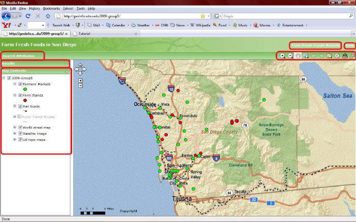
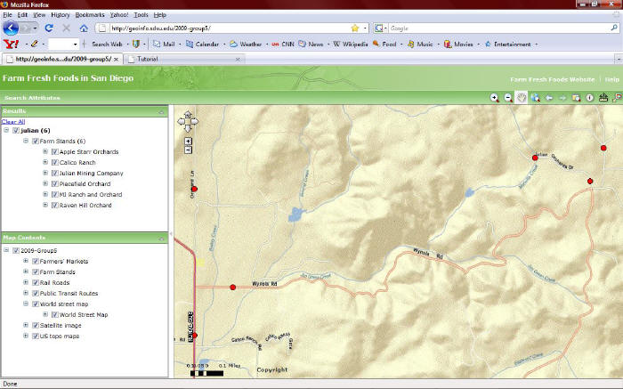
Toolbar
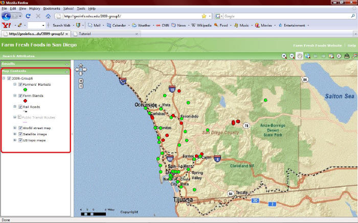
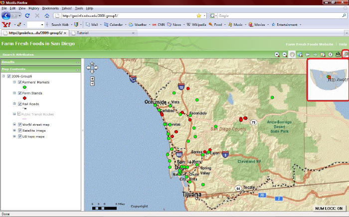
Layers and map contents Map layers are types of data shown on the map, such as "Farmers' Markets," "Farm Stands," "Rail Roads," and "Satellite Map." You can view the list of the contents of the map, turn on/off layers, and view the symbols for layers.
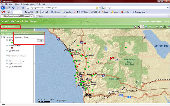
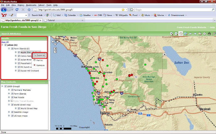
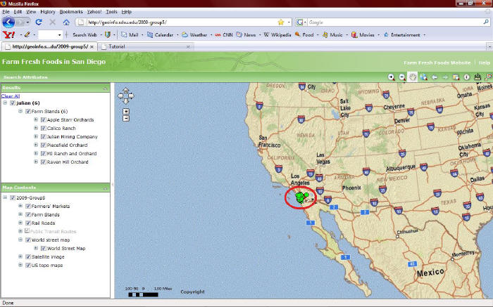
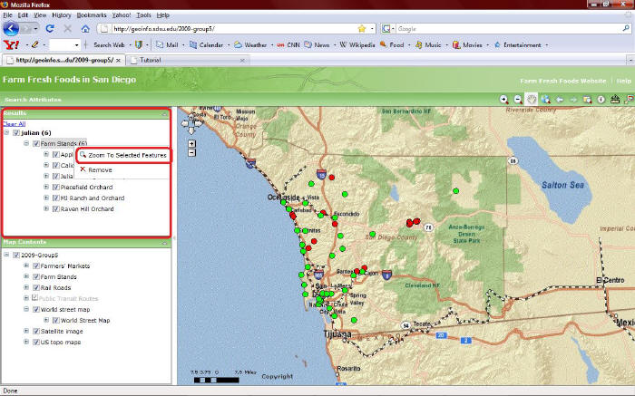
Search for features In the menu area, "search attribute" enables you to search one or more layers for text that you enter, to find an address, or to search for places using a Web database. Your search result will show in the result panel.
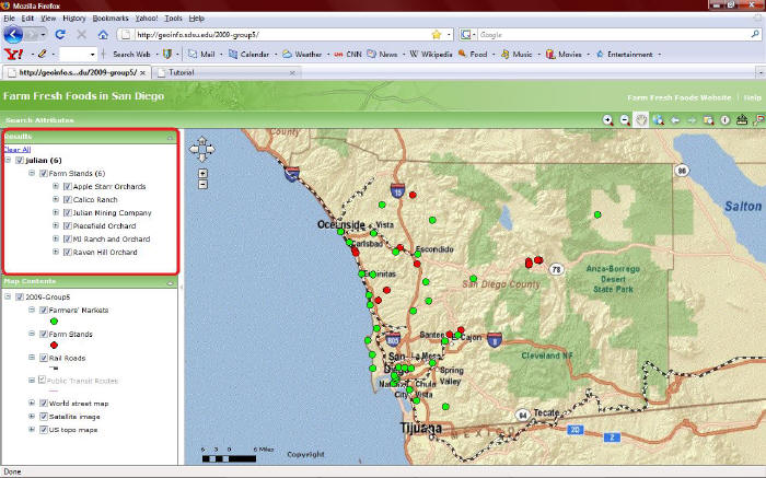
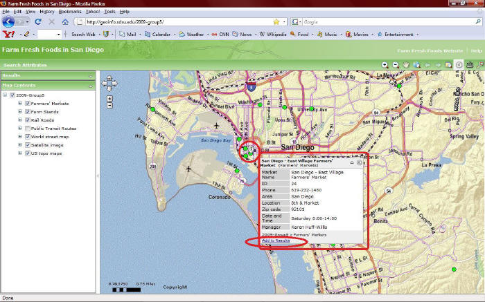
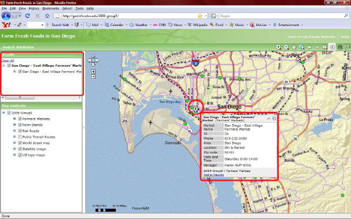
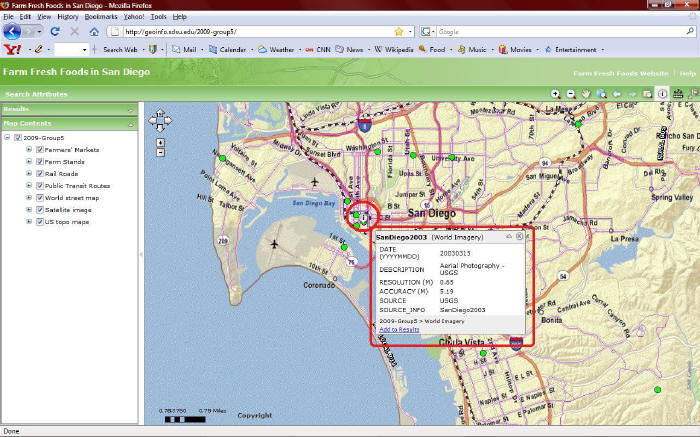
Using Results The results panel displays the output from using the Identify tool after clicking the "Add to Results" at the bottom of the callout box. The results panel also displays the output from a search using "search attribute."
Potential Problems Unfortunately, we have some potential problems on our map and still haven't fix them yet even though Dr. Ming helped to fix those problems. One of the potential reasons, it may connect to ESRI resources on our map that may not accept to manage/alter their default settings by the individual mapping creator. Here are the lists of problems for our map.
Sorry, it is inconvenient........ We hope you can manage those problems when using our map!
For more details about tutorial, please click websites: Web Mapping Application Help You can also visit website: ESRI Support Center
Please click here to use our map. Have fun!
Please click here to see explanation about our map.
|
|
Send mail to
bilbo1usa@yahoo.com with
questions or comments about this web site.
|