Old Mapping Prototypes
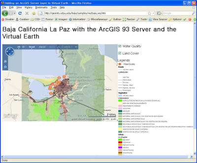
The ESRI provides the ArcGIS Server APIs for the Google Maps API,
the Microsoft Virtual Earth, Flex and Microsoft Sivlerlight. Among
them, this web application is developed by the ArcGIS JavaScript
Ext. for Microsoft Virtual Earth. Identify and Layer toggling
functions will be implemented.
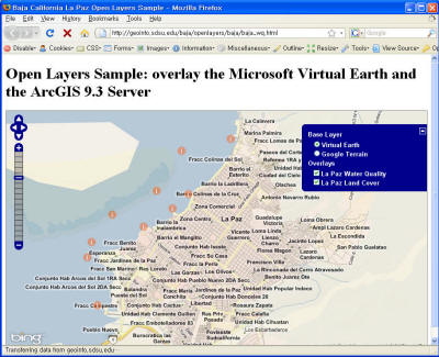
This online mapping application is developed by ESRI ArcGIS
Server 9.3 and OpenLayers. This application is slower than the web
application by ArcGIS JavaScript Ext. for Microsoft Virtual Earth.
However, this web application can show the layers. The OpenLayers
that support the ArcGIS rest services is not stable yet.
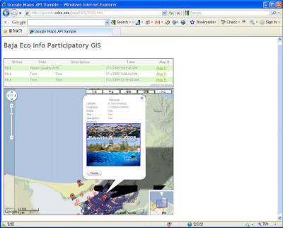
The Participatory GIS is a web application so that users can share
their opinions about target places. Developing of this application
is in progress. Now, you can post your opinion and see the lists
that other users posted. When you click the hyperlink, the PGIS site
will show up and automatically log in. When you click one place on
the map, you can see the "Create Discourse" balloon. Then, you can
write your opinion and upload photos or KML files. This web site is
developed by Chung-rui Lee, Jayesh Patel and Ick Hoi Kim.
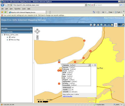
This web application is the basic template that the ArcGIS Server
offers. When you click one of points (water quality data), you can
see information about the water quality monitoring data from January
to November in 2008.
|