Current Progress of Mobile GIS
Currently, we are developing
the use of dynamic multi-user tracking in wireless environments.
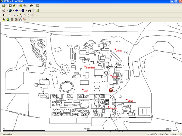
Users need a mobile device with ESRI's ArcPad as a client, a GPS device, and a wireless internet connection via the mobie device.
The dynamic multi-user real time tracking software for wireless environments consist of three parts:
C++ ESRI ArcPad extension
Java Server Component
Java demonstration package
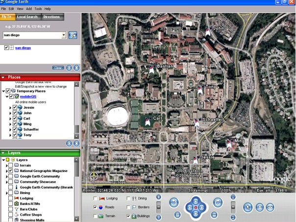
Users can see itself and other's the exact location both on a mobile device and a Google Earth.
Future Work:
Deployment of trackingserver
Test with mulitple mobile devices
The extension code has to be refactored in an more objected oriented way
The internetconnection has to be secured as an ssl connection
More information: go to Mobile GIS section in Multimedia GIS homepage