


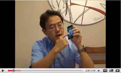
NEW! Location Based Services in iPod Touch (Google Earth)
Demonstration of Location-based Services ( LBS) (Google Earth, Google Map) on iPod Touch
YouTube:
http://www.youtube.com/v/4px4T4RN5Hk
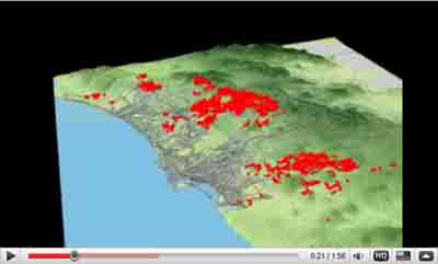
3D Animation of San Diego 2003 and 2007 Wildfire
Created By Aude Esperbe.
In this animation, the first part is the 2003 CEDAR fire (orange color), and then the
2007 fires (Red color). The brown points in between represent the area that used to be
burned by the 2003 fire. We can compare the spatial pattern between the two major wildfire
and see their differences.
More San Diego Wildfire Maps at map.sdsu.edu
YouTube:
http://www.youtube.com/watch?v=cYcoU5wQNmM
Click here to download this video!
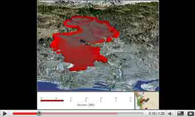
Cedar Fire (2003 October Wild Fires)
Visulization and animation of the how the Cedar Fire spread out. View from the west looking east.
YouTube:
http://www.youtube.com/watch?v=sTgFU1sE_Sg
Click here to download this video!
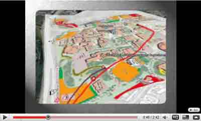
Google Earth Tour of SDSU
A 3D virtual tour of San Diego State University and surrounding attractions accessible by trolley/bus by Dr. Ming-Hsiang Tsou and Grad. Student Tony Howser.
YouTube:
http://www.youtube.com/watch?v=msmSXRYXy8I
Click here to download this video!
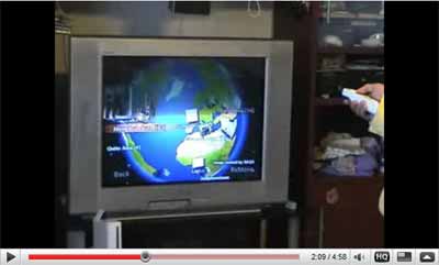
Wii Virtual Globe Demo
A virtual Globe demo in Nintendo Wii by Dr. Ming-Hsiang Tsou.
YouTube:
http://youtube.com/watch?v=nzRVcCLJOxc
Click here to download this video!
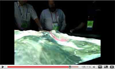
3D Touch Table
This is an interesting demonstration of the touch panel plasma screen which allows us to interact with geospatial data in real time. It takes us one step ahead to visualize, analyze, collaborate and allows us to make better decisions.
YouTube:
http://www.youtube.com/watch?v=W3dz2xpCJVU
Click here to download this video!
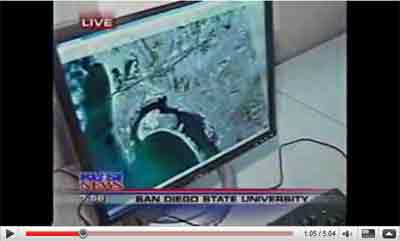
KUSI News9 Report: Covering Geospatial Technologies at SDSU
KUSI News9 covered the Geospatial technologies news in Geography Department of San Diego State University.
YouTube:
http://www.youtube.com/watch?v=QLxuvI1YVYw
Click here to download this video!
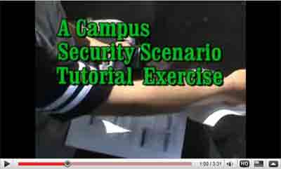
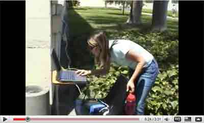
A Campus Security Scenario Tutorial Exercise
Wireless Mobile GIS and GPS Testing in SDSU Campus.
YouTube:
http://www.youtube.com/watch?v=dQg22p5Bu1s
Click here to download this video!
Field Investigation Documentary Film
Testing integration of Mobile GIS, Wi-Fi, GPS, and Internet Map outdoor in Mission Trails Regional Park (MTRP).
YouTube:
http://www.youtube.com/watch?v=4ij_ZZLMzxc
Click here to download this video!
Integrating Moble GIS Demonstration
Demonstration of combining pocket PC with Moblie GIS software (ArcPAD), wireless communication, GIS, and GPS.
YouTube:
http://youtube.com/watch?v=dQg22p5Bu1s
Click here to download this video!
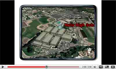
Helix High Tour of Cutting Edge GIS Technology
Google Earth 3D Virtual Tour from Lemon Grove to Helix High School.
YouTube:
http://youtube.com/watch?v=_XrKNAVgp0Q
Click here to download this video!