Get & Check Latitude & Longitude Coordinates
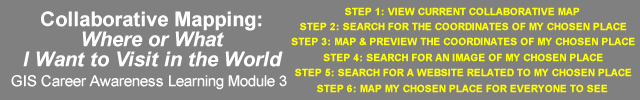
( STEP 3: MAP & PREVIEW THE COORDINATES OF MY CHOSEN PLACE)
- STUDENT INSTRUCTIONS
- Not all latitude and longitude coordinates are accurate. This map tool will help you get more precise coordinates so you can accurately map your chosen place for everyone.
- Your goal is to get the most precise latitude and longitude coordinates of your chosen place. Think of it as "homing in" to your chosen place.
- Enter your current latitude & longitude coordinates in the fields below and click on the Go button. (These coordinates may have already been "entered" for you.)
- Use the map navigation tools on the left of the map and the overview map to get closer to your chosen place.
- Once you are close enough, click directly on the map location where you want to get the new coordinates.
- If your chosen place is a large area like a country, try to obtain the coordinates of the approximate center of your chosen place. You may have to zoom out for this.
- After verifying your coordinates or getting more accurate coordinates, copy them down and move to STEP 4: SEARCH FOR AN IMAGE OF MY CHOSEN PLACE
Geographic Position Coordinates
Latitude(y)
Longitude(x)
(DECIMAL DEGREES)
example longitude: -117.2610°(don't include Degree ° symbol)
example longitude: -117.2610°(don't include Degree ° symbol)