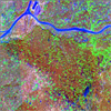
NASA developed technologies, such as Earth Science Enterprise (ESE) satellite data, very high resolution (VHR) airborne imaging, and image registration and automated object detection routines will be integrated with commercial satellite data, web-based geographic information systems (GIS), integrated global positioning system/personal data assistants, and ground-based sensors, in a SDSS framework.
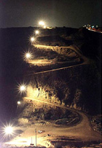
Additionally, satellite data will enable assessment of fire risk to border security agents and weather-related risks to undocumented immigrants. Mobile communication equipment, web-based GIS, spatial models, and remote hand-held computers with GPS will link directly to the SDSS, to facilitate resource allocations and enforcement actions. This technology integration will also enable agencies to assess environmental degradation and fire risk, and to prepare to mobilize for natural and bio-terrorist hazards.
The goal of this study is to develop a BSDSS that will be utilized by all levels of the USBP and collaborating local, state, and federal agencies to tactically and strategically allocate and disseminate personnel and technology resources for securing the international borders of the US. Developments of these technologies will be shared and transferred to other NASA investigators through our participation in the Strategy for the Evolution of ESE Data Systems (SEEDS) consortium.


9.23-26 2008 GIScience 2008 will be held in Park City, Utah.
11.27 2005 San Diego Emergency Response GIS Data Portal Released
8.9-8.13 2004 ESRI International User Conference
3.14-3.19 2004 The 100th AAG Annual Meeting
1.14.04 Website Updated
10.31.03 Website Created

 |
|
Home Agencies Tasks SEEDS Schedule Contact
Send comments to: Site Manager. Last Updated: Saturday, July 23, 2005